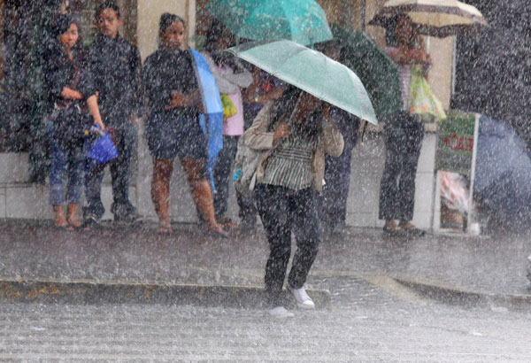
Manila: Even as Typhoon Butchoy, also known as Nepartak, had already left the Philippine Area of Responsibility (PAR), Metro Manila and several provinces in Central Luzon remained under water due to rains brought by the southwest monsoon.
“The National Disaster Risk reduction and Management Council is still closely watching rainfall, episodes of floods and landslides in northern Cordillera Region, all of northern and central Luzon, Metro Manila, and southern Luzon,” Gulf News quoted NDRRMC Executive Director Ricardo Jalal as saying.
“The public is advised to refrain from doing outdoor activities such as picnics near rivers and waterfalls, mountaineering, and spelunking — due to continuing threats of floods and landslides,” Jalal reportedly said, adding, “We have directed regional Office of Civil Defence to continue assessing all disaster areas even if the typhoon is already gone.”
“Southern Luzon’s Mindoro, including Metro Manila — they are 400 kilometres away from northern Luzon — are still inundated with relentless rains. Three rivers in southern Luzon’s Calapan are in danger of overflowing,” said Esperanza Cayanan, chief of the state-run weather station Pagasa. “Some 1,000 residents in Hermosa, Bataan (central Luzon) experienced waist-deep waters which cascaded from nearby mountains.”
“Reports from northern Luzon (which is nearer Taiwan) are more dismal,” said Cayanan, but did not give details.
Because of Nepartak’s belated effect, it has been called a “phantom typhoon,” said Josie Cruz, a resident in Metro Manila’s Quezon City which has been witnessing dark and cloudy days since July 6.
The social welfare department reportedly said it has distributed relief goods and supplies to isolated areas that were affected by heavy rains.
There were no reported deaths in all affected provinces, according to the Department of Interior and Local Government (DILG).
Nepartak was a tropical depression when it developed on the Pacific Ocean off Guam on June 30. It was quite weak when it entered the PAR near north on July 4, but it became a super typhoon with sustained winds at 280 kilometer-per hour as it headed to Taiwan on July 6. It left Taiwan Strait on July 8, and made a landfall over Shishi, Fujian on July 9, reported Gulf News.
About 20 storms devastate the Philippines every year.