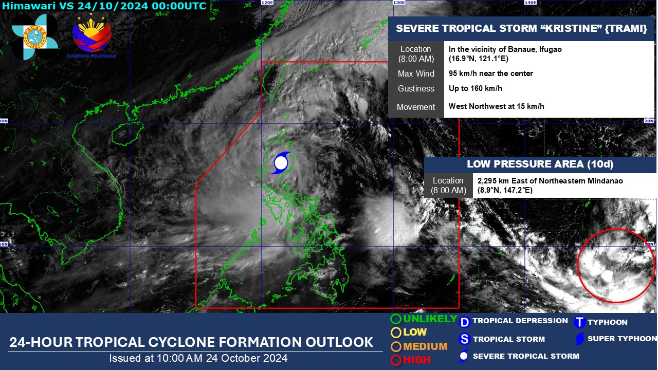
Many have been affected by Severe Tropical Storm Kristine (international name: Trami), and now there’s a significant possibility of another low-pressure area (LPA) east of northeastern Mindanao developing into a tropical depression.
According to PAGASA, the LPA is currently located 2,295 km outside the Philippine Area of Responsibility (PAR). Once it enters PAR, it is likely to intensify into a tropical depression and will be given the local name “Leon.”
PAGASA also reported that its forecast for October 23-29 indicates that the weather disturbance is expected to enter the northeastern boundary of the PAR before moving toward Japan.
In a Balitanghali report, PAGASA assistant weather services chief Chris Perez said that with this new tropical depression brewing, Philippine residents can expect rainfall not only in Northern Luzon but also in Central Luzon.
Meanwhile, residents anticipated Kristine to move toward the West Philippine Sea (WPS) and exit the PAR by Friday. However, PAGASA has indicated that there is a chance Kristine could return to PAR, moving eastward or east-northwestward after looping over the WPS on Sunday and Monday.
This scenario will depend on the behavior of the weather disturbance (Leon) located east of PAR, which may develop into a tropical depression within the next 24 hours.
PAGASA said: “Kristine is forecast to re-intensify as it moves over the West Philippine Sea. While it is likely that the tropical cyclone will remain a severe tropical storm in the next five days, the chance for it to be upgraded into a typhoon is not ruled out.”