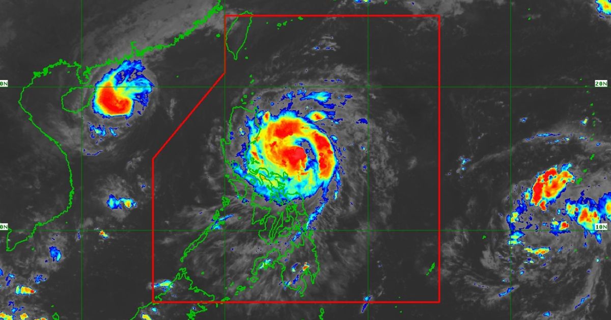
More areas are under Wind Signal 2 as Severe Tropical Storm Nika (international name: Toraji) approaches typhoon strength on Sunday, Nov. 10.
According to the Philippine Atmospheric, Geophysical and Astronomical Services Administration (PAGASA), Wind Signal 2 has been raised over:
- northern portion of Aurora
- southern portion of mainland Cagayan
- Nueva Vizcaya
- southern portion of Apayao
- Abra
- Kalinga
- Mountain Province
- Ifugao
- Benguet
- northern portion of Nueva Ecija
- southern portion of Ilocos Sur
- La Union
- Isabela
- northeastern portion of Pangasinan
- Quirino
Minor to moderate threat to life may be expected in the mentioned areas.
The following areas are under Wind Signal 1, which may pose minimal to minor threat to life and property:
- rest of Cagayan including Babuyan Islands
- rest of Apayao
- Ilocos Norte
- rest of Ilocos Sur
- rest of Pangasinan
- rest of Aurora
- Tarlac
- the northern and central portions of Zambales
- the rest of Nueva Ecija
- Pampanga
- Bulacan
- Metro Manila
- Rizal
- the eastern portion of Laguna
- the eastern portion of Quezon including Polillo Islands
- Camarines Norte
- Camarines Sur
- Catanduanes
- the northeastern portion of Albay
PAGASA said there is a moderate to high risk of storm surge in low-lying or exposed coastal localities of Ilocos Norte, Ilocos Sur, La Union, Pangasinan, Cagayan including Babuyan Islands, Isabela, Zambales, Aurora, Quezon including Polillo Islands, Camarines Norte, Camarines Sur, and Catanduanes.
Meanwhile, the northeasterly windflow will cause strong to gale-force gusts over Batanes.
At 5 p.m., Nika was monitored 380 kilometers east of Infanta, Quezon.
It has maximum sustained winds of 110 kilometers per hour (kph) and gustiness of up to 135 kph, moving westward at 20 kph.


