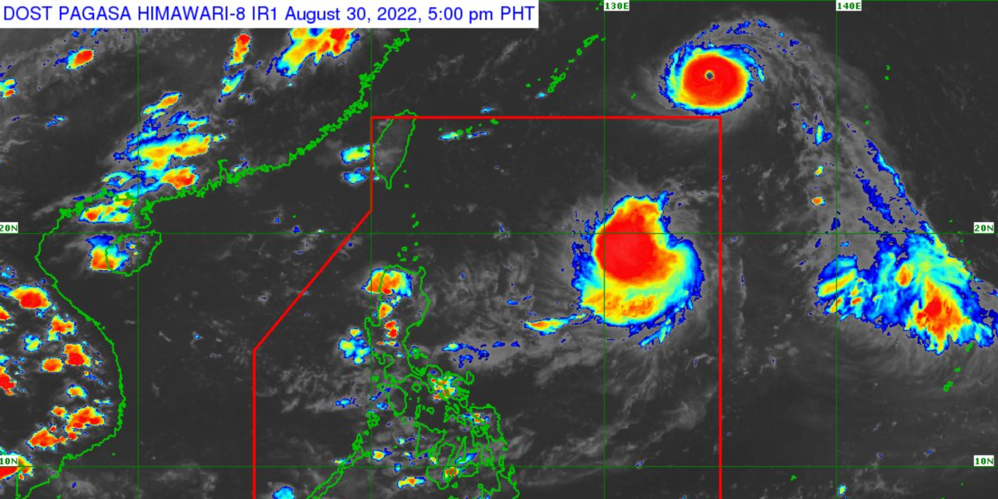
A super typhoon with the international name Hinnamor is expected to enter the Philippines area of responsibility on Wednesday night (August 31), according to PAGASA.
TROPICAL CYCLONE BULLETIN NO. 1
Tropical Depression “#GardoPH”
Issued at 5:00 PM, 30 August 2022
Valid for broadcast until the next bulletin at 11:00 PM todayTHE LOW PRESSURE AREA EAST OF EXTREME NORTHERN LUZON DEVELOPS INTO TROPICAL DEPRESSION “GARDO” pic.twitter.com/oJQDOtotkJ
— PAGASA-DOST (@dost_pagasa) August 30, 2022
As of 5:24 Tuesday bulletin, the weather bureau said the low pressure area (LPA) east of Extreme Northern Luzon has developed into Tropical Depression ‘Gardo’.

The typhoon packs 185 kph maximum sustained winds and up to 230 kph gusts, the weather agency added—which makes it fall under Category 5 or super typhoon.
Its trough is expected to cause scattered rains and thunderstorms over the region Calabarzon and the provinces of Aurora and Camarines Norte.
Residents of these areas are cautioned to watch out for flash floods and landslides due to light to moderate, to at times heavy rains.

Earlier in March, PAGASA revised its definition of a “super typhoon” to those with maximum sustained winds of at least 185 kilometers per hour.


