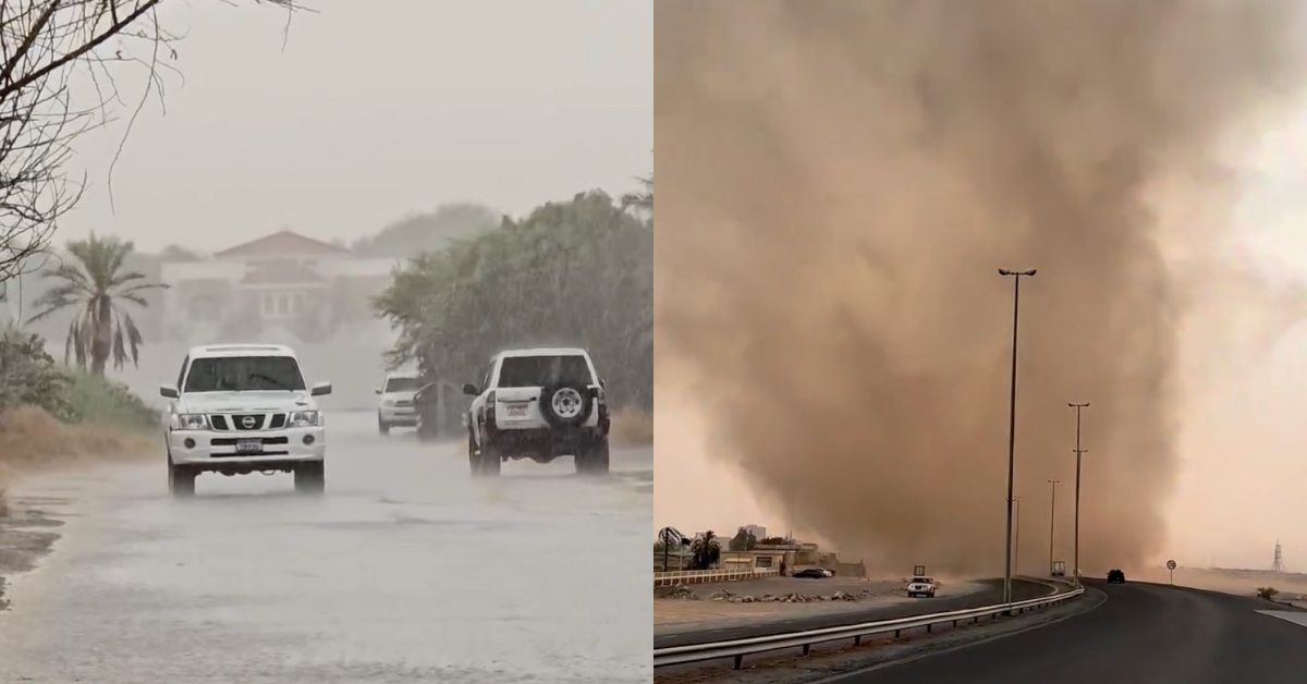
Heavy rain and strong winds swept across parts of the UAE on Monday night, July 28, with videos capturing summer downpours across roads and highways.
Along Dubai-Al Ain Road and Sharjah’s Central Region, thunderstorms brought intense rainfall and gusty winds, prompting motorists to slow down due to reduced visibility. Videos shared by Storm Centre on Instagram showed rain pelting windshields and water streaming down the road as vehicles cautiously navigated the conditions.
View this post on Instagram
View this post on Instagram
In another clip, a tornado-like sand whirlwind, commonly referred to as a dust devil, was seen swirling across a stretch of open road, forming a tall column of sand that temporarily blanketed the area.
View this post on Instagram
Rain also led to water accumulation on the roadside in parts of Al Madam and Al Faya in central Sharjah, as well as in sections of Al Ain City. The cooler conditions brought a welcome break from the intense summer temperatures.
View this post on Instagram
View this post on Instagram
Weather forecast
In an advisory issued Tuesday, July 29, the National Center of Meteorology (NCM) said the shift in weather was caused by an extension of a surface low-pressure system from the East, combined with an upper air high-pressure system.
A low-pressure system near the ground brings unstable weather, like clouds, rain, and wind. Meanwhile, the high-pressure system in the upper air can trap heat or help fuel storm clouds. When both systems interact, they can lead to sudden changes in weather, such as thunderstorms, wind, and short but heavy rains.
“Fair to partly cloudy and hazy at times with a chance of convective clouds formation East and Southward associated with rainfall. Light to moderate winds freshening at times during daytime causing blowing dust. The sea will be slight in the Arabian Gulf and in Oman Sea,” the NCM noted in its forecast for Tuesday.
In the four-day forecast covering Wednesday to Saturday (July 30 to August 2), the weather is expected to remain fair to partly cloudy, with clouds appearing eastward and northward. There is a continued chance of convective cloud formation, especially in eastern regions, possibly bringing more rainfall.
Winds will remain light to moderate, occasionally strengthening during the day with speeds reaching up to 40 km/h, which may stir dust in exposed areas.
Meanwhile, temperatures are expected to rise to 49°C in internal regions, with highs of 47°C in coastal and island areas. Mountain regions will be slightly cooler, with maximums reaching 39°C.
Humidity levels will vary, with peak readings of up to 85% expected overnight and in the early morning, especially in coastal and mountainous areas.