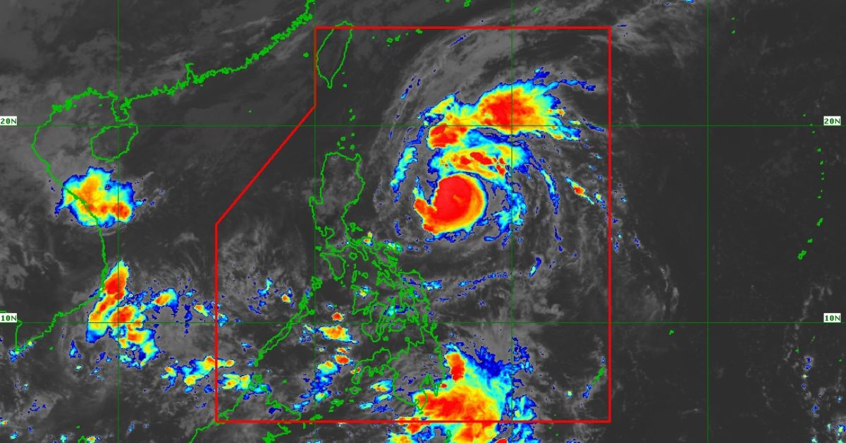
Marce, a tropical cyclone threatening Luzon just a week after a devastating storm hit a large portion of the main island, is now a typhoon while still over waters off Aurora province on Tuesday morning, Nov. 5, according to the state weather bureau Philippine Atmospheric, Geophysical and Astronomical Services Administration (PAGASA).
Its 11 a.m. bulletin stated that more areas are under wind signal no. 1 These are:
- Batanes
- Cagayan including Babuyan Islands
- Isabela
- Ilocos Norte
- Apayao
- Abra
- Kalinga
- Mountain Province
- Ifugao
- Northern portion of Nueva Vizcaya (Diadi, Bagabag, Ambaguio, Villaverde, Bayombong, Solano, Quezon, Kasibu)
- Northern portion of Quirino (Diffun, Saguday, Cabarroguis, Aglipay, Maddela)
- Northern portion of Aurora (Dilasag, Casiguran, Dinalungan)
“The highest wind Signal which may be hoisted during the occurrence of Marce is Wind Signal No. 4,” PAGASA said.
PAGASA warned of strong to gale-force gusts in the provinces of Ilocos Sur, Aurora, Quezon, and Camarines Norte, particularly in coastal and upland areas without natural wind barriers.
It said the typhoon was 590 kilometers east of Baler, Aurora at 10 a.m., with peak winds of 120 kilometers per hour (kph) and gusts of up to 150 kph.
Moving west northwest at 30 kph, the weather bulletin stated that Marce may hit land near the Babuyan Islands or the northern tip of mainland Cagayan on Thursday evening or early Friday morning.
“Due to uncertainty in the strength of the high pressure area north of Marce, the forecast track may still change and bring the landfall point to mainland Cagayan-Isabela area. Marce may exit the Philippine Area of Responsibility region on Friday evening or Saturday (Nov. 9) early morning,” PAGASA said.


